DEVILS GARDEN

NOVEMBER 2011 & NOVEMBER 2016
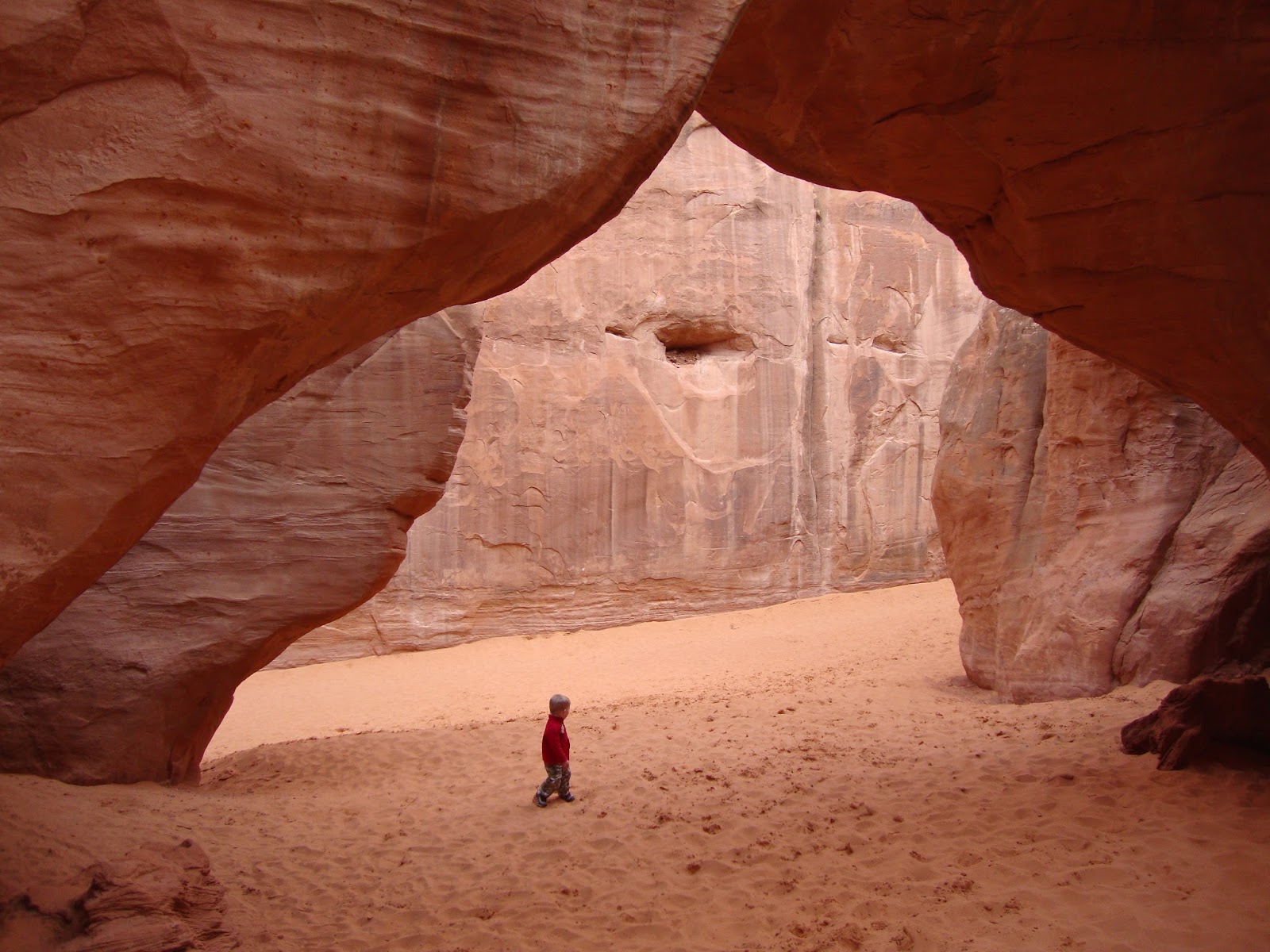
PINE TREE ARCH

PINE TREE ARCH

TUNNEL ARCH

LANDSCAPE ARCH

NAVAJO ARCH

DOUBLE O ARCH

DOUBLE O ARCH

THE FINS

Devils Garden is one of my favorite hikes in Arches National Park. It is roughly nine miles round-trip if you take all of the spur trails, and passes by many cool arches and rock formations. Not far from the trailhead, a spur trail will take you down to Pine Tree and Tunnel Arches and then continue on to Landscape Arch, the fifth-longest natural arch in the world. 

A little past Landscape Arch you will pass the recently collapsed Wall Arch, and another spur trail leading to Navajo Arch and Partition Arch. The trail then continues to Double O Arch where you have the option of continuing on to Dark Angel or taking a primitive trail back to Landscape Arch. I remember being unimpressed with Dark Angel, but really enjoying the primitive trail, as it passes by another arch and some really cool rock fins. The primitive trail is also a lot less crowded than the main trail.  

This is understandably a popular trail, so try to go in the off-season or early in the morning if you want to beat the crowds. I first hiked this on Thanksgiving weekend mistakenly assuming this would be a slow time of year. It turns out Thanksgiving is a very popular time to visit Arches. If you really want solitude, plan to go between December and March. Though be sure to check the weather as Moab can get hit by large snow storms every now and then. I remember having a rough ride out of Moab on a snow-covered road during one of my winter trips to the area.  

DELICATE ARCH

NOVEMBER 2011

DELICATE ARCH

DELICATE ARCH

ARCH ALONG THE TRAIL TO DELICATE ARCH

PETROGLYPH NEAR THE TRAILHEAD

The three-mile round-trip hike to Delicate Arch is probably the most popular hike in Arches National Park, so you will want to hike it in the winter or early in the morning if you want to beat the crowds. I last hiked this trail on a Thanksgiving weekend and was surprised how crowded it was. I was there in the afternoon after doing another hike that morning, and remember getting the very last spot in the main parking lot. I also remember passing a train of people coming down the trail on my way up.

Once at the arch, I had to wait a while to get a photo of it without anyone standing underneath it, as there was a line of people waiting to have their pictures taken with the arch. So while not the most peaceful hike, it is one you have to do at least once. If I were to do it again I would go in the winter, or first thing in the morning, in order to beat the rush. Though watch the weather if you go in winter. The trail includes some uphill and downhill sections on slick rock, so it could be difficult to hike if it were covered in ice or snow.    


CORONA ARCH

NOVEMBER 2015

CORONA ARCH

CORONA ARCH

BOWTIE ARCH

The Corona Arch Trail is a nice three-mile round-trip hike to two amazing arches. The hike is located on BLM land several miles outside of Moab on Potash Road. Because it is located outside of the National Parks, it seems to fly under the radar a little bit. I'd been hiking southern Utah for about ten years before I finally found out about it. Apparently Corona Arch had become a popular place for people to tie ropes to and swing off of, until the BLM banned the practice when it started to get out of control.   

I hiked to Corona Arch around sunset during Veterans Day weekend, and only saw a few other hikers along the trail. The trail is very well maintained, and there are even steel cables and a ladder to help you with the steep sections. Just before reaching Corona Arch you will see Bowtie Arch to your left in a small alcove.       

JEEP ARCH

 OCTOBER 2023

JEEP ARCH

JEEP ARCH

JEEP ARCH

JEEP ARCH


Jeep Arch is nice four-mile roundtrip loop hike located about twelve miles outside of Moab along Potash Road, just 0.3 miles past the Corona Arch Trailhead. From the parking area you will immediately walk through a long tunnel underneath the railroad tracks, which is pretty fun, before turning left and beginning a short climb. The trail is marked with cairns and colored markings on the slickrock, which you will need to pay close attention to as its possible to get off course if you let your mind wander too much. 

After 1.2 miles, you will come to a signed junction where you will begin the 1.6 mile loop portion of the hike. I would suggest taking a left, as this will allow you a nicer, longer view of the arch as you approach it. The trail will take you right up to, and through, the arch to the other side where the loop trail continues back to the junction. 

While this hike takes you to a very large, impressive arch with nice views along the way, it doesn't appear to be too well known, or get a lot of traffic compared to other hikes in the area. I only saw two other groups of hikers when I visited the first week of October in 2023. I was actually unaware of this hike until just prior to visiting.     


THE WINDOWS

MARCH 2011, NOVEMBER 2015 & NOVEMBER 2016

TURRET ARCH

TURRET ARCH

THE WINDOWS

NORTH WINDOW

NORTH WINDOW

NORTH WINDOW FROM THE PRIMITIVE TRAIL

SOUTH WINDOW FROM THE PRIMITIVE TRAIL

The Windows is a pleasant, well-maintained, one-mile loop hike that takes you by three arches. This is a great hike for little kids, as you get to see three amazing arches without much effort. It is a popular trail, so if you want some serenity, you will need to either hike it in the winter or first thing in the morning. There is a primitive trail located behind The Windows which I recommend taking, as it is less crowded than the main trail and gives you a different perspective of the arches. 

SAND DUNE ARCH


MARCH 2011 & NOVEMBER 2011

SAND DUNE ARCH

SAND DUNE ARCH

ALONG THE TRAIL TO SAND DUNE ARCH

SLOT NEAR SAND DUNE ARCH

ALONG THE TRAIL TO SAND DUNE ARCH

Sand Dune Arch is a pleasant 0.4-mile round-trip hike located along the main road through Arches National Park. The sandy trail to the arch stays fairly cool as it passes between tall sandstone fins. The arch is really nice, with some beach-like sand located around its base. There are also a few very-short slot canyon located along the trail and near the arch that can be fun to explore.  

FUNNEL ARCH

FEBRUARY 2018

FUNNEL ARCH

FUNNEL ARCH FROM BEHIND

FUNNEL ARCH

FUNNEL ARCH

PETROGLYPH NEAR THE BIRTHING SCENE 

Funnel Arch is a short walk to a cool arch located just south of Moab. While fairly easy to access, it does not seem to be be too well-known. In all my trips to the Moab area, I had never heard of it until just before visiting in February of 2018. Also, there does appear to be some debate regarding its name. Some sites call it Funnel Arch while others call it Cable Arch. Funnel appeared to be the most common, so that is what I went with. The hike is accessed from a dirt pullout along the side of Kane Springs Road, just a little past the Birthing Scene Petroglyphs. There was no marker designating the parking area, so bring good directions. From the parking area, you will scramble straight up the hillside until reaching the top, and then veer to your right until the arch becomes visible. 

It is only about a half-mile to the arch, but there are a couple steep sections that require a bit of effort to get up. I hiked to Funnel Arch first thing in the morning during a trip in February and had the whole place to myself. It was a really peaceful area with a nice alcove located directly behind the arch. You may want to avoid this hike during popular times, as I hear it is a popular arch for people to rappel off or swing on with ropes. After visiting the arch, it is worth stopping at the Birthing Scene Petroglyphs on your way back to Moab as it is just a half mile from the Funnel Arch parking area. It is a large rock located along the side of the road with a variety of petroglyphs etched around it on all side.   


DOUBLE ARCH

MARCH 2011 & NOVEMBER 2016

DOUBLE ARCH

BELOW DOUBLE ARCH

DOUBLE ARCH

BELOW DOUBLE ARCH

The Double Arch Trail is a flat, sandy 0.8-mile round-trip hike leading to one of the largest and most impressive arches in Arches National Park. Most people combine this hike with The Windows hike as they are located just across the parking lot from each other.

MORNING GLORY ARCH

JULY 2017

MORNING GLORY ARCH

MORNING GLORY ARCH

MORNING GLORY ARCH

MORNING GLORY ARCH

MORNING GLORY ARCH

Morning Glory Arch is a five-mile round-trip hike located on BLM land just three miles west of Moab along Highway 128. While the hike is located outside of Arches National Park, there is a well-marked National Park quality trail leading to the arch. Much of the trail follows along a stream with some vegetation which can help to make it cooler than it would otherwise be. However, as I hiked this trail in the late afternoon over the Fourth of July weekend, I remember feeling the heat on this trail. 

Morning Glory Arch is the ninth-largest natural arch in the world, and you will be able to see it about a half-mile before you get to it. Because it is located just in front of a large sandstone wall, it can be hard to get a photo of it that does it justice. It's one you have to see in-person to truly appreciate. The arch is located in a large shady alcove with several trees watered by a natural spring coming right out of the sandstone near the base of the arch. Because I was hiking this trail in the summer during the hottest time of the day, I got to have the arch and alcove all to myself.   

FISHER TOWERS

 SEPTERMBER 2023

KINGFISHER

ANCIENT ART

ANCIENT ART

TITAN

COTTONTAIL & ECHO TOWERS

COTTONTAIL & ECHO TOWERS

Fisher Towers is an approximately four-mile roundtrip hike located about thirty minutes east of Moab along Highway 128. The trail is relatively flat with amazing views the entire way as it takes you along the base of several dramatic sandstone towers. This area is also popular with rock climbers. I'm assuming this trail receives a large number of visitors due to how large the parking area, however, I didn't encounter many other hikers when I visited in the evening during the last week of September, 2023. The drive from Fisher Towers to Moab is also very scenic, as the road follows along the Colorado River past some impressive mesas.